
The goal of the interactive mapping within the Belair at Bowie Flight to Freedom is to define and visually represent
the city's neighborhoods at different points in history. How were the boundaries of the Queen Anne and Vansville
districts carved into present day Bowie? Who lived, worked and worshiped there?
In this section of the website, historically significant maps are accessible and linked to relevant information about
the contemporary population of Bowie, Maryland. Careful review, comparison and reflection on these maps with primary
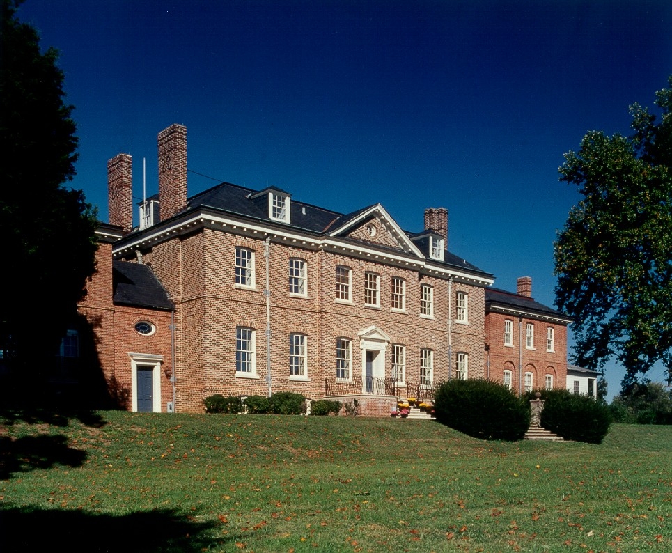
documents will reveal connections between the people and places where the history of this town built around Belair
Mansion was forged. Individuals and sites are highlighted on the maps for the researcher with both geographic referencing
and biographical information. Ultimately, the maps should uncover social and cultural groupings significant to this
central area of Prince George's County.
Enter the place name or individual's name you wish to search for.
Example: Smith, John or Railroad
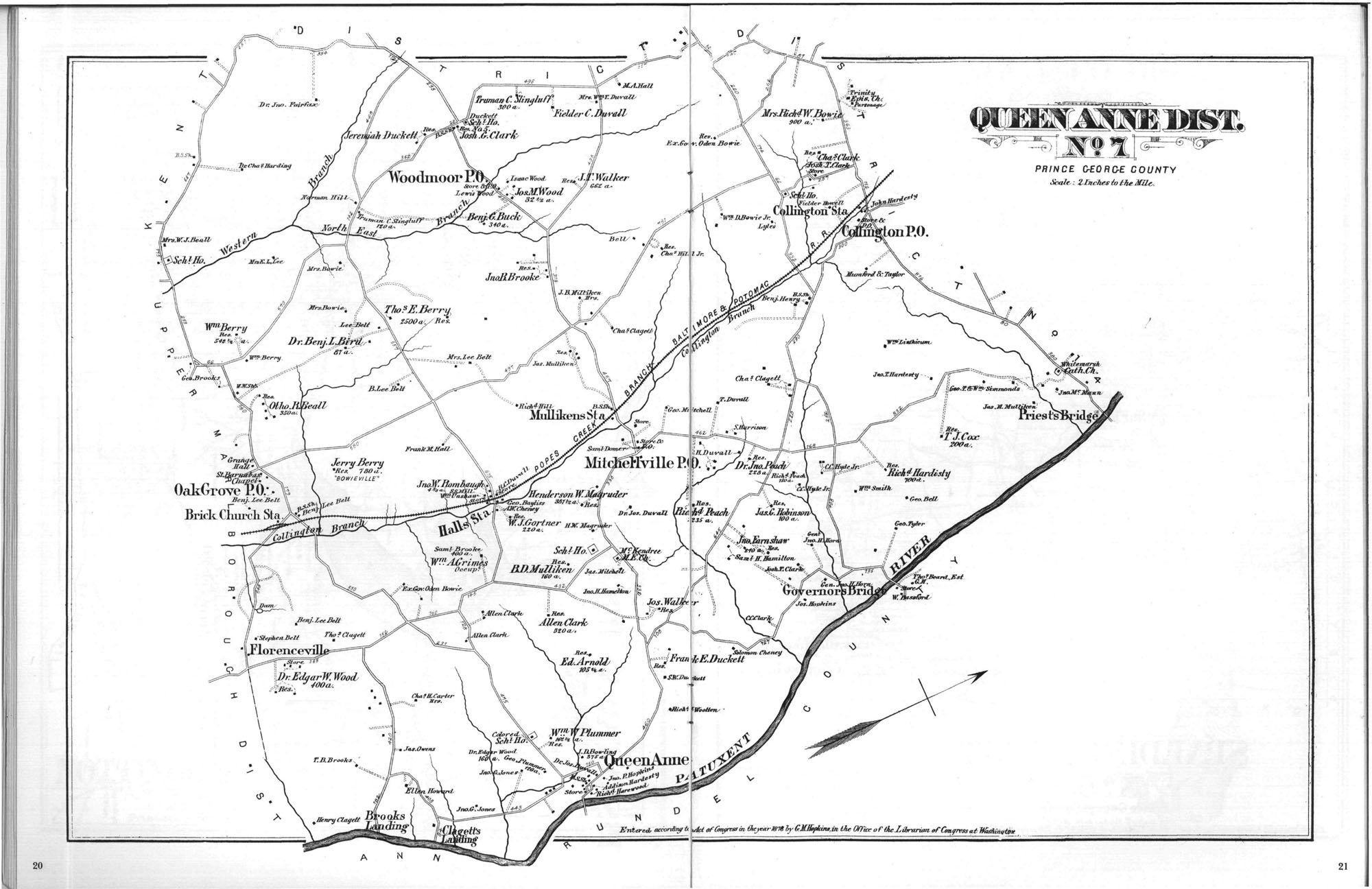
- District No. 7 (Queen Anne's District) - G.M. Hopkins 1878 Atlas of Prince George's County
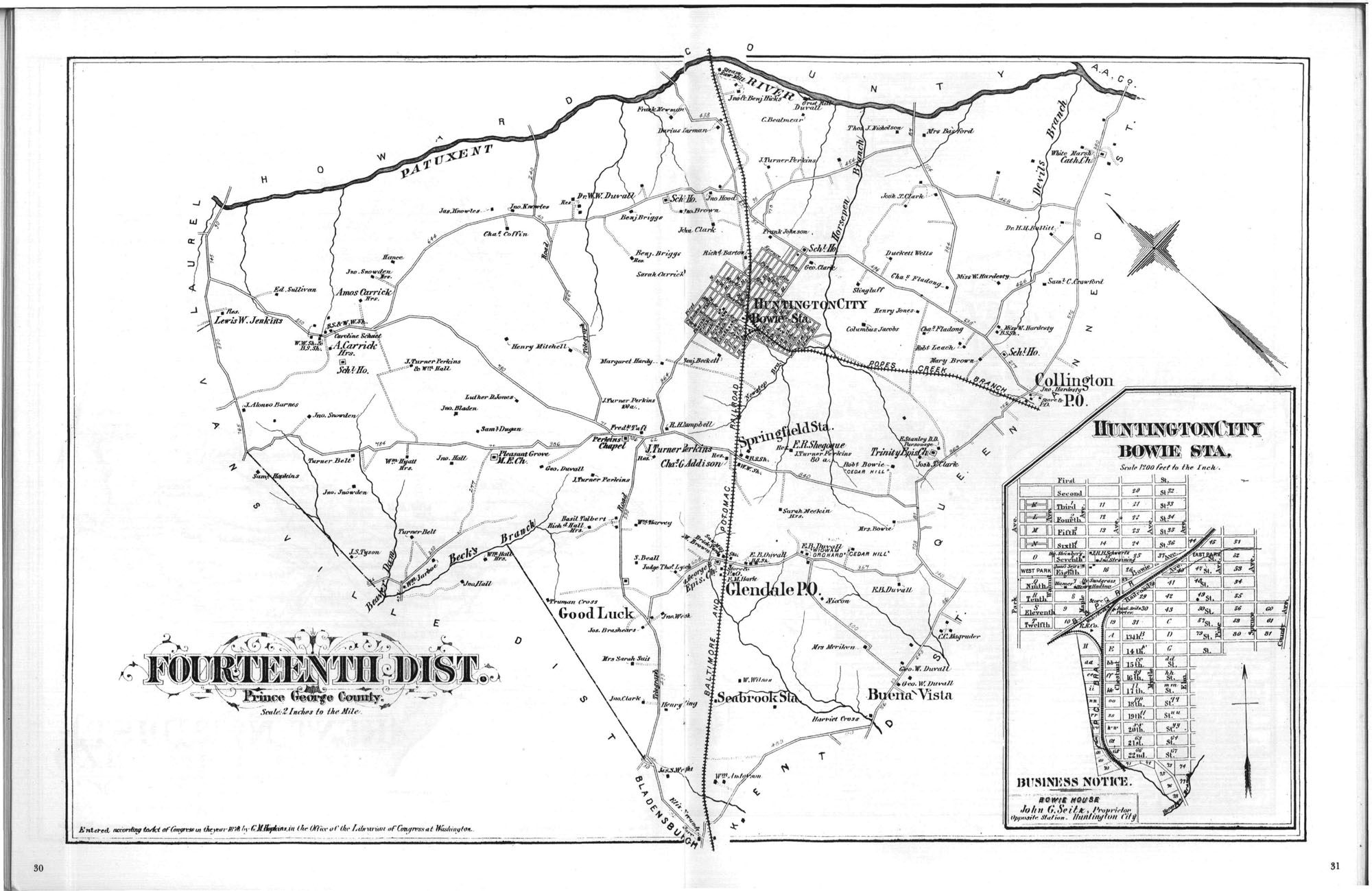
- District No. 14 - G.M. Hopkins 1878 Atlas of Prince George's County
- Vansville District - Simon J. Martenet, Martenet's Atlas of Maryland, 1861, Library of Congress, MSA SC 1213-1-118
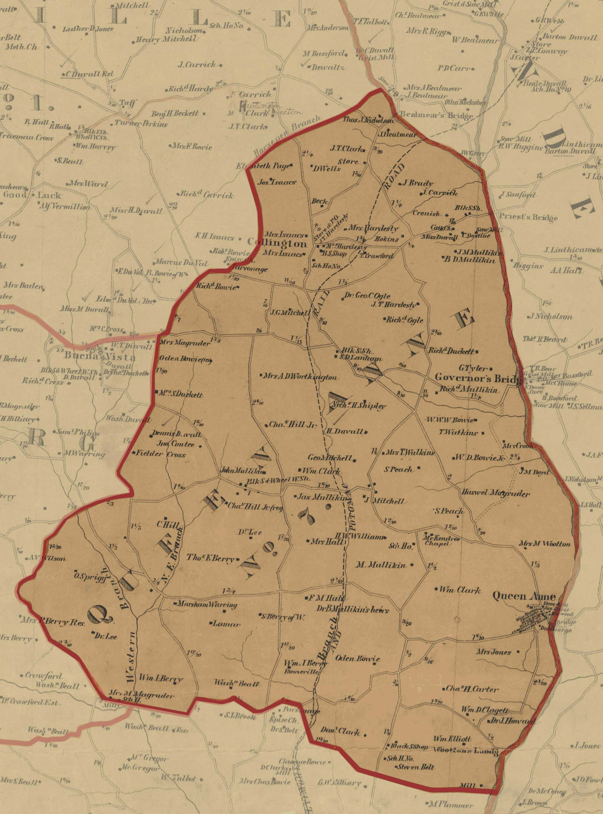
- Queen Anne's District - Simon J. Martenet, Martenet's Atlas of Maryland, 1861, Library of Congress, MSA SC 1213-1-118