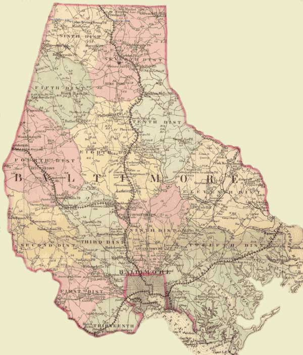
Beneath the Underground: The Flight to Freedom. Icons used in advertisements for runaway slaves by the Planter's Advocate (P.G. Co., ca. 1850s)
Resources: Interactive Maps Search:
Home
  • Beneath the Underground 
  • Antebellum Maryland
  • Maryland Communities 1830-60
  • Flight to Freedom
  • Circumstances of liberation
  • Stories of Flight
  • Case studies 
  • Interactive Maps
  • Locating the participants 
  • Search our Database  New!
  • Collection of Records 
  • Research Resources
  • Resouces for academic study 
  • Grants
  • Reports and information
  • Related Projects
  • Projects studying slavery 
  • Links
  • Electronic resources
  • Contact Us 
  • Comments or questions
  • Baltimore County
    Baltimore County. Simon J. Martenet, Martenet's Atlas of Maryland, 1865, Huntingfield Collection, MSA SC 1399-1-75

    Click on a district for a detailed map.
    Please note that the district level map images are large, and may take a long time to load.

    Baltimore County. Simon J. Martenet, Martenet's Atlas of Maryland, 1865, Huntingfield Collection, MSA SC 1399-1-75
    Enter the place name or individual's name you wish to search for.
    Example: Smith, John


    Map Help

    ©Copyright  Maryland State Archives

    Baltimore City Baltimore County District 6 Baltimore County District 7 Baltimore County District 5 Baltimore County District 10 Baltimore Country District 8 Baltimore County District 4 Baltimore County District 2 Baltimore Country District 3 Baltimore County District 9 Baltimore County District 11 Baltimore County District 12 Baltimore County District 1