MapsThe goal of the
mapping within the Blacks in Annapolis project is to define and visually represent the city's neighborhoods at different points in history. For example, what did the areas of West Street, Clay Street and Bay Ridge Avenue look like during the late nineteenth and early twentieth centuries. Who lived and worked there?
In this section of the website, historically significant maps are accessible and linked to relevant information about the contemporary population of Annapolis. Careful review, comparison and reflection on these maps with primary documents such as the federal census and city directories reveal connections between the people and places where Annapolis’ history was made. Individuals and sites are highlighted on the maps for the researcher with both geographic referencing and biographical information. Ultimately, the maps should uncover concentrations of economic and social groupings significant to Annapolis’ past and present.
|
|
|
|
|
|
|
|
| Select a Map of Annapolis (Actual View) |
|
 |
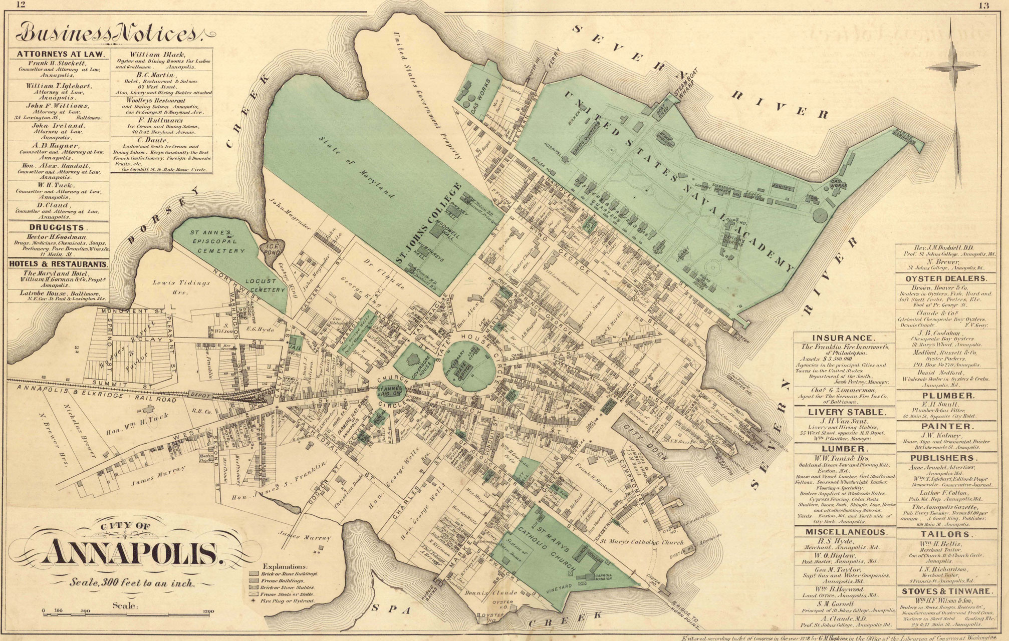
George M. Hopkins, 1878 - Plate of Annapolis, 1878, courtesy of the Galesville Heritage Society, MSA SC 5439-1-1 |
|
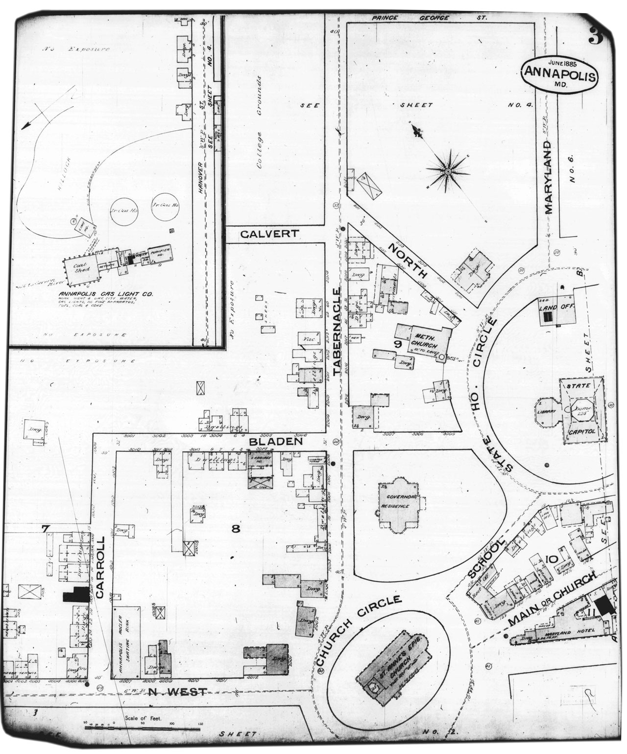
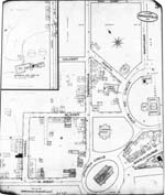
Sanborn Insurance Map, 1885 - Detail from Sanborn Map Company, Insurance Maps of Annapolis, 1885, Library of Congress, MSA SC 1213-1-350. |
|
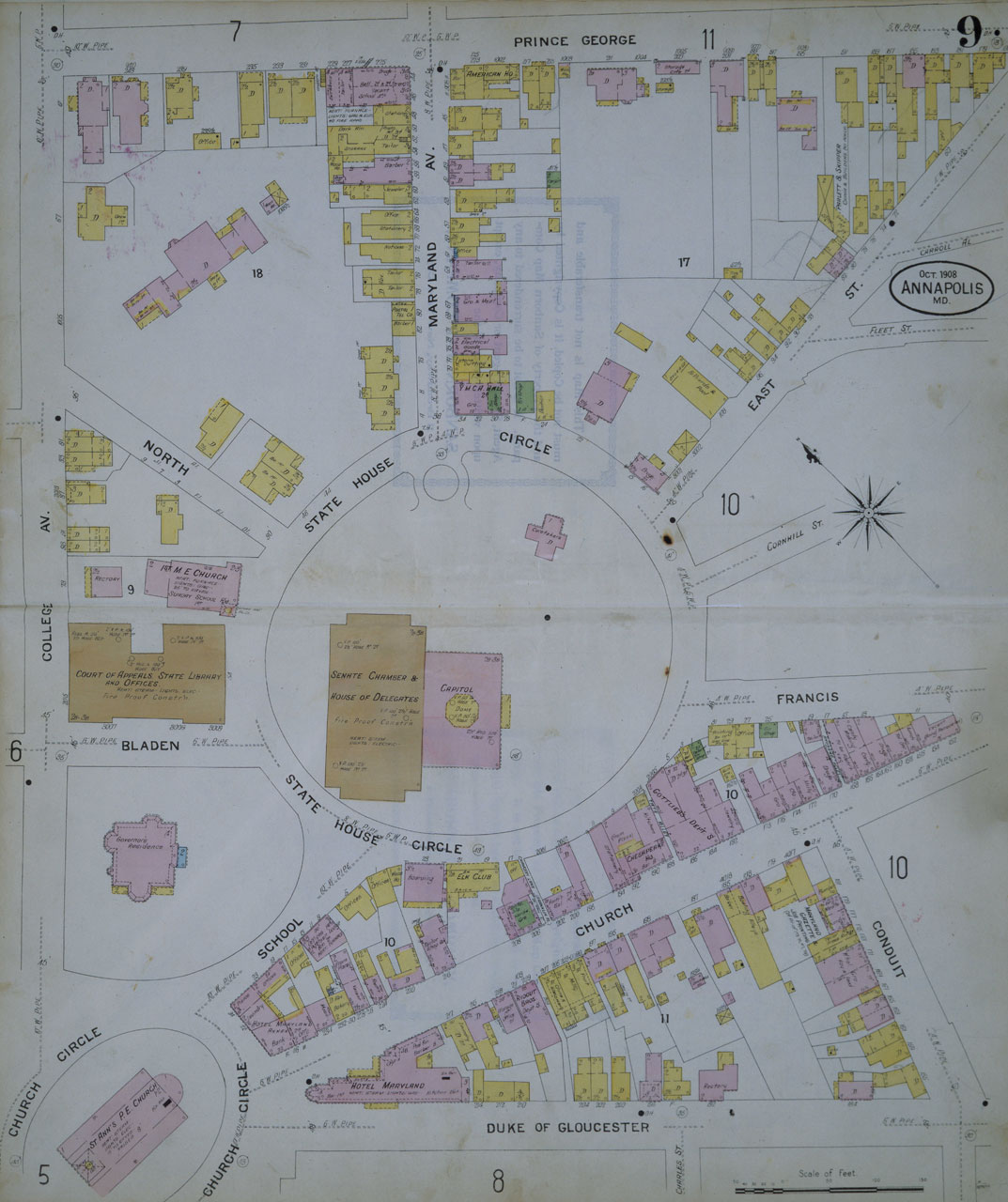
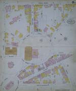
Sanborn Insurance Map, 1908 - Plate of Insurance Maps of Annapolis and Eastport, 1908, Annapolis City Engineer's Office |
Select Map of Annapolis (Screen View)
1878 George M. Hopkins Map
 |
1885 Sanborn Insurance Map
 |
1908 Sanborn Insurance Map
 |
|
|
|
|
| |