Beneath the Underground: The Flight to Freedom. Icons used in advertisements for runaway slaves by the Planter's Advocate (P.G. Co., ca. 1850s)
Resources: Interactive Maps
Home
  • Beneath the Underground 
  • Antebellum Maryland
  • Maryland Communities 1830-60
  • Flight to Freedom
  • Circumstances of liberation
  • Slavery & the War of 1812
  • Case studies 
  • Stories of Flight
  • Case studies 
  • Interactive Maps
  • Locating the participants 
  • Search our Database  New!
  • Collection of Records 
  • Research Resources
  • Resouces for academic study 
  • Grants
  • Reports and information
  • Related Projects
  • Projects studying slavery 
  • Links
  • Electronic resources
  • Contact Us 
  • Comments or questions
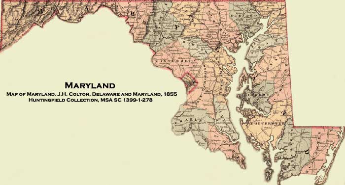
  • Map of Maryland. J.H. Colton, Delaware and Maryland, 1855, Huntingfield Collection, MSA SC 1399-1-278

    Click on a county for a detailed map

    The Interactive Maps component of the Flight to Freedom project allows historians, genealogists, and researchers to search for Maryland property owners and occupants during and, to a limited degree after, the antebellum period in a visual setting. Simply mouse over the map to read the county names, and click to view a map of that county. Click on a district to get a detailed map of that area, including names of residents, churches, schools, factories, town names, and some major roads. Click on a name for more information. You may also search directly for a name, place, and in the case of Baltimore City, street, by entering it in the Search box below. Note that this is a work in progress and we may not have yet coded the maps with the person or place you are looking for.

    Please note that the maps used may change between the state, county, and district levels.
    These maps are best viewed using the most recent version of Firefox or Internet Explorer.

    Enter the place name or individual's name you wish to search for.
    Example: Smith, John


    Map Help
    All maps are available for purchase from the Maryland State Archives

    © Copyright July 01, 2019 Maryland State Archives

    Washington County Frederick County Carroll County Montgomery County Washington D.C. Prince George's County Charles County St. Mary's County Calvert County Anne Arundel County Howard County Baltimore City Baltimore County Harford County Cecil County Kent County Queen Anne's County Talbot County Caroline County Dorchester Somerset County Worcester County Somerset County Western Allegany County Eastern Allegany County